
Burren [Boireann]
Good walks are even better shared.
Overview
Burren [Boireann]
Introduction
Nestled in County Clare, the Burren, or Boireann, is a landscape that resembles something from another planet. With its limestone pavements, unique flora, and captivating history, it's no wonder that both seasoned hikers and casual walkers flock to this natural wonder.
Geology
The Burren's formation is a geological masterpiece, crafted during the last Ice Age over 200 million years ago. The limestone pavement is adorned with crevices known as 'grikes', providing habitats for a variety of plant species, some of which are rare and endemic to this region.
Routes
One of the most popular routes is the Burren Way, a moderately challenging trek that spans approximately 18 km through enchanting limestone landscapes. This route allows walkers to immerse themselves in the local flora and fauna while enjoying the distinct beauty of the Burren's natural architecture.
Summit Features
Upon reaching the summit, adventurers are greeted by a large cairn marking the peak. The views here are nothing short of spectacular. On a clear day, you might even catch a glimpse of the Aran Islands and the dramatic Cliffs of Moher, so don't forget your camera!
Terrain Type
The terrain is predominantly rugged limestone interspersed with scenic grassy patches. Ideal for anyone looking to test their footing; just watch out for those pesky lose stones!
Views
The Burren offers some of the finest views in Ireland. The highlights include vistas of the Atlantic Ocean as well as stretches of the Burren's famous ridges. To make the most of your experience, visit in spring or autumn when the wildflowers are in full bloom and the weather is pleasantly mild.
Hazards
While the Burren is a stunning place to hike, it's essential to be cautious. Loose stones can be tricky, and steep drops can be daunting if you're not paying attention. After rain, the paths can be quite slippery, so tread carefully.
Nearby Summits
For those who crave more adventure, nearby summits like Slieve Elva and Mullaghmore await, offering even more breathtaking panoramas and hiking opportunities.
Access
Getting to the Burren is relatively straightforward. The nearest parking can be found at the Burren Centre in Kilfenora, a great starting point for your explorations. Public transport is also feasible, with regular buses connecting Kilfenora to Ennis. The friendly village of Kilfenora is your best bet for amenities, including cafés and restrooms.
Facilities
After a day of adventure, head to the Burren Centre to refuel at the café or take advantage of the toilet facilities. Various other options are available in Kilfenora, perfect for a post-hike meal.
History
The name 'Burren' is derived from the Irish 'Boireann', which translates to 'great rock'. This name reflects the rugged beauty of the landscape. The Burren is not just precious for its natural wonders; it is a UNESCO Global Geopark, rich in archaeological significance, featuring ancient burial sites and monastic remains that whisper tales of the past.
Conclusion
In a nutshell, the Burren is a hiker's dream, blending natural beauty, geological intrigue, and rich history into one captivating destination. So lace up your boots, grab your walking stick, and get ready to discover the magic of Boireann!
Explore routes near Burren [Boireann]
Public walks starting within 80 km of this hill. Nearby does not mean a route reaches the summit; check its map and access before setting out.
No public routes are currently listed within 80 km of Burren [Boireann] on Walkmates. This does not mean there are no paths here. Explore the map and check local access information before planning a walk.
Route planning notes
These notes describe possible approaches, not verified navigable routes or permission to cross land. Check current paths, local access rules and conditions before setting out.
Burren Way
A scenic route that traverses the Burren landscape, combining footpaths and rural lanes. Wander through limestone fields and enjoy the variety of wildlife along the way.
Make a day of it, together
Find someone to share the walk with, or organise a day out along a route you like.
Hill facts and local notes
Classifications
Elevation
380m
1,247 ft
Prominence
158m
Coordinates
51.9597, -8.9075
W376789
OS Map
79
At the Summit
At the summit, hikers will find a large cairn and breathtaking views of the surrounding landscape, including the Atlantic Ocean on clear days.
Terrain & Geology
The Burren is renowned for its limestone pavement, formed during the Ice Age. This unique geology creates a captivating landscape featuring expansive rocky terrains dotted with rare flora.
Views & Scenery
The Aran Islands, the Cliffs of Moher, and sweeping vistas of the Burren National Park.
History & Heritage
Name Origin
The name 'Burren' comes from the Irish 'Boireann' meaning 'great rock', aptly describing the mountainous limestone landscape.
Historical Significance
The Burren is a UNESCO Global Geopark, known for both its geological and archaeological significance, including ancient burial sites and monastic settlements.
Getting There & Facilities
Check current local access restrictions, parking rules and transport timetables before travelling. These notes do not confirm public access to the summit.
Parking
There is a small car park located at the Burren Centre in Kilfenora, providing easy access to various walking trails.
Public Transport
Buses run regularly from Ennis to Kilfenora, with connections to the Burren area.
Nearby Facilities
The Burren Centre offers a café and toilet facilities, and there are additional options in nearby Kilfenora.
Safety Information
Known Hazards
- Be mindful of loose stones and steep drops, especially after rain when paths can be slippery.
General Safety Tips
- Check weather conditions before setting out
- Carry appropriate clothing and equipment
- Let someone know your planned route
- Take a map, compass, and GPS device
- Carry emergency supplies: food, water, first aid kit, torch
Hills
Some common questions about the hills answered
Are there group walks up Burren [Boireann]?
Many walkers use Walkmates to join or organise walks with others. You can check for group walks around Burren [Boireann] through the maps
Are there other walkers around Burren [Boireann]?
Activity varies by location and time, but Walkmates lets you see whether others have shared walks or shown interest in this area. Find other people through the walking friends search walking friends for Burren [Boireann] search or of course create your own walk for Burren [Boireann]
Can I organise a walk to Burren [Boireann]?
Yes. If there aren’t any walks listed already, you can create a walk and make it available for others to join.
If you're signed up to Walkmates, you can create a walk to Burren [Boireann].
How do I find a walk up this hill?
There are often multiple ways to walk this hill, depending on experience and route preference. Walkmates helps you explore walks and routes that others have shared.
Can I suggest a new route up Burren [Boireann]?
Yes. You can suggest or create routes to share with others. Walkmates focuses on the social side of walking, so routes are used to help people organise walks and explore areas together, rather than as detailed navigation tools or route libraries.
Other uses really appreciate knowledgeable walkers sharing their routes. Share your favourite route to Burren [Boireann] here
The is an error or something incorrect about this hill. How do I let you know?
We always strive to keep the information on Walkmates as accurate as possible. If you find an error, please let us know through the contact form and we'll aim to correct it as quickly as possible
Community Discussion
Comments
Location
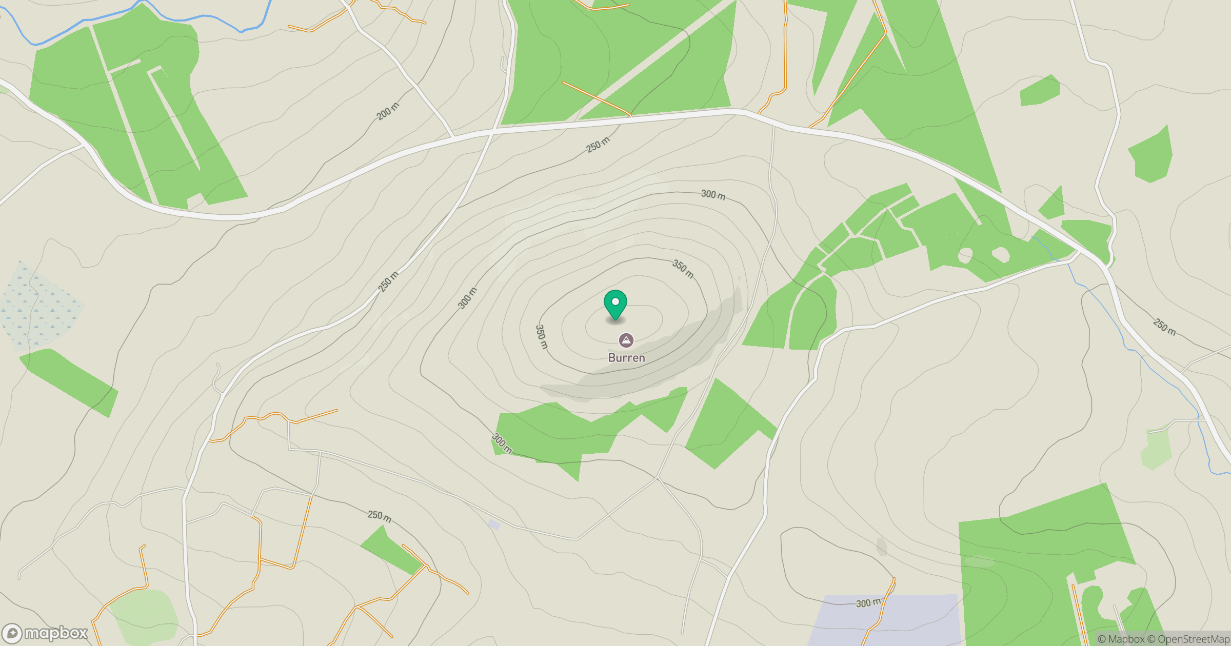
Grid reference: W376789
View on OpenStreetMapOpens a map in a new tab, centred on the hill.
Hills within 30 km
Straight-line distance, not a walking route or confirmation of access.
No comments yet. Be the first.